Another Slow-Moving Storm Creating a Threat of Flooding this Week
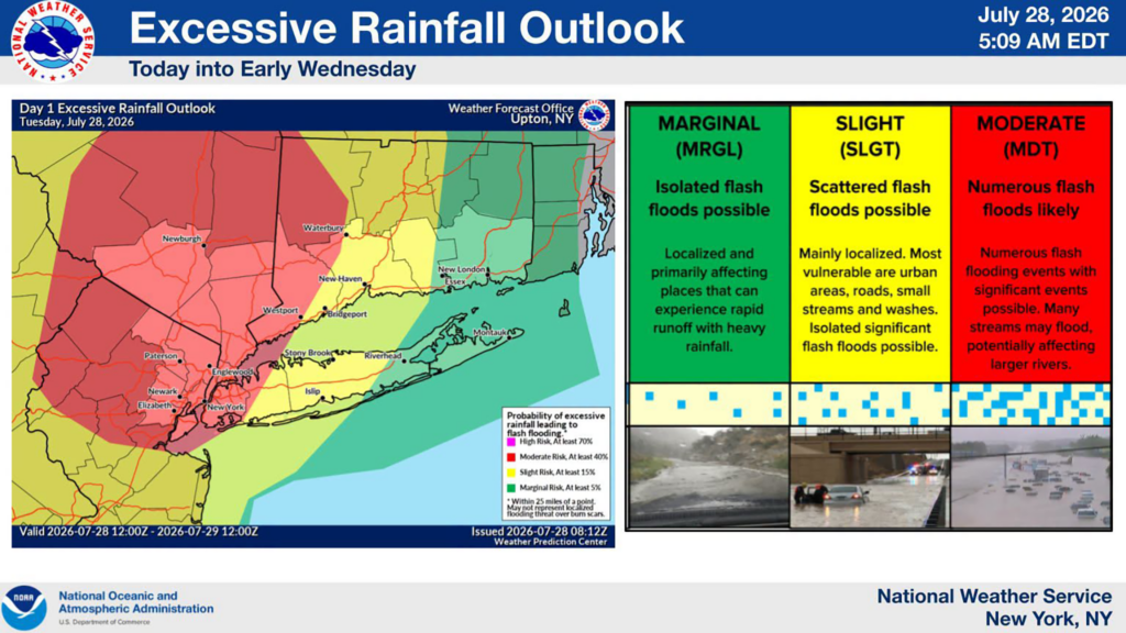
The Tri-State is once again under a Flood Watch running through 8:00 p.m. Wednesday, July 29th. A slow-moving low pressure system will bring in multiple rounds of heavy showers and thunderstorms across the region today and tomorrow, and the National Weather Service warns of the potential for life-threatening flash flooding, with the greatest threat from late today afternoon into Wednesday morning.
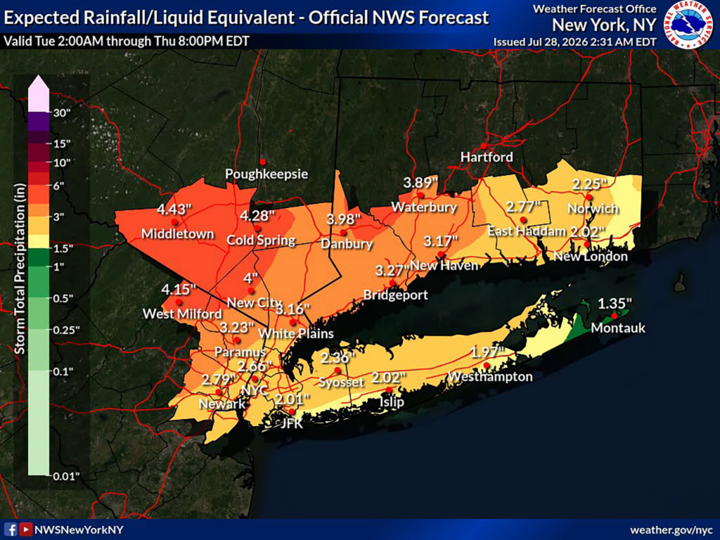
Forecasters expect an average of 2 to 3 inches of rain across the city, with isolated totals above 5 inches possible; the official NWS forecast puts 2.66 inches on Central Park and just over 2 inches at JFK through Thursday evening. North and west of the city, in the Lower Hudson Valley, northeast New Jersey, and southwest Connecticut, averages of 3 to 5 inches are expected, with isolated amounts above 7 inches.
Rate matters more than total, and this is where the concern lies. The Weather Service says there is a high likelihood of an inch of rain per hour for several hours, with isolated peaks of 2 to 3 inches per hour. New York City’s sewer system is designed to handle roughly 1.75 inches per hour. Any downpour that outruns that pace sends water into streets, underpasses, and basements faster than the drains can take it away, and the Weather Prediction Center has placed the city under a Moderate Risk for excessive rainfall today, its second-highest category, meaning numerous flash floods are likely.
There is a wind threat on top of the water. Isolated severe thunderstorms this afternoon and evening could produce gusts of 60 to 70 mph, mainly across northeast New Jersey and the city, strong enough to bring down trees and power lines.
Low-lying Housing and Basement Apartments Again at Most Risk
Below-grade housing in Queens has repeatedly proven to be where the greatest danger and worst property damage occur during heavy rains. Residents of basement and cellar apartments, and anyone on a block that floods regularly, should have an exit plan ready before the heaviest rain arrives tonight: know your way out, keep documents and medications within reach, and leave early rather than late if water begins to enter your home.
Highest Flooding Threat
The heaviest rounds of rain are expected from late Tuesday afternoon into Wednesday morning. Lingering heavy showers will remain an isolated threat going through late Wednesday, before the watch expires at 8 p.m. Before the storm, you may call 311 to report clogged catch basins or storm drains.
Conditions are expected to improve Thursday. Until then, keep phones charged in case storms bring down power lines, stay off the roads during the heaviest downpours, and check on your neighbors that may reside in basement units before the rain intensifies.